SAR Halls Well
From TrainzOnline
(Difference between revisions)
m |
m |
||
| Line 74: | Line 74: | ||
<tr valign="top"> | <tr valign="top"> | ||
<td width=750> | <td width=750> | ||
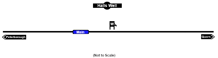
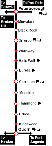
| + | <span style="font-weight: 700;"><span style="color: white; background-color: black;"> Distance from Peterborough: </span> 51½ kms, 32 miles</span><br> | ||
| + | |||
Unmanned location on the <span style="font-weight: 700; color: white; background-color: black;"> Peterborough-Quorn Line </span>.<br> | Unmanned location on the <span style="font-weight: 700; color: white; background-color: black;"> Peterborough-Quorn Line </span>.<br> | ||
Latest revision as of 09:48, 8 September 2022
|
 |