Help:Mobile Surveyor
Tonyhilliam (Talk | contribs) |
Tonyhilliam (Talk | contribs) |
||
| Line 1: | Line 1: | ||
The Surveyor Module provides a set of tools that enable anyone to create their own [[Help:Route|Route]] and [[Help:Session|Sessions]]. This can be a simple looped track or a prototypical masterpiece using real-world data and accurately modeled and placed track and scenery. | The Surveyor Module provides a set of tools that enable anyone to create their own [[Help:Route|Route]] and [[Help:Session|Sessions]]. This can be a simple looped track or a prototypical masterpiece using real-world data and accurately modeled and placed track and scenery. | ||
| − | |||
| − | |||
| − | |||
= Getting Started = | = Getting Started = | ||
| Line 13: | Line 10: | ||
* "Edit Session" - Available from the Session sub-menu after selecting "View sessions" from the Routes menu. This opens the selected gameplay session for editing in Surveyor. By default, any edits occur in the session layer. | * "Edit Session" - Available from the Session sub-menu after selecting "View sessions" from the Routes menu. This opens the selected gameplay session for editing in Surveyor. By default, any edits occur in the session layer. | ||
| + | {{Template:Surveyor_Mobile_Tools}} | ||
| − | = Overview = | + | = Surveyor Overview = |
Surveyor provides a powerful set to tools that allow you to create incredibly detailed worlds. You can sculpt and paint terrain; populate the world with scenery items such as trees, cars and buildings; lay "spline" objects such as tracks, roads, fences and catenary; add trackside objects such as signals; add trains to your tracks; even change the weather conditions. In Trainz Simulator you can also add and edit the Rules to create customized Driver Sessions. (Note that In Trainz Driver 2, you can issue Driver Commands to multiple trains through Quickdrive, but there is no Rules access in Surveyor). | Surveyor provides a powerful set to tools that allow you to create incredibly detailed worlds. You can sculpt and paint terrain; populate the world with scenery items such as trees, cars and buildings; lay "spline" objects such as tracks, roads, fences and catenary; add trackside objects such as signals; add trains to your tracks; even change the weather conditions. In Trainz Simulator you can also add and edit the Rules to create customized Driver Sessions. (Note that In Trainz Driver 2, you can issue Driver Commands to multiple trains through Quickdrive, but there is no Rules access in Surveyor). | ||
Revision as of 14:05, 22 July 2014
The Surveyor Module provides a set of tools that enable anyone to create their own Route and Sessions. This can be a simple looped track or a prototypical masterpiece using real-world data and accurately modeled and placed track and scenery.
Getting Started
Surveyor is entered through the "Routes" menu tile at the Trainz main menu. There are four options for entering Surveyor which each have a slightly different effect:
- "Create Route" - Available from "Routes" menu, opens a new blank baseboard in Surveyor. By default, any edits occur in the route layer (see layers below).
- "Edit Route" - Available from "Routes" menu, opens the selected route for editing in Surveyor. By default, any edits occur in the route layer.
- "Create Session" - Available from the Session sub-menu after selecting "View sessions" from the Routes menu. This creates a new gameplay session for the selected route and opens Surveyor so that you may begin editing the session. By default, any edits occur in your new session layer.
- "Edit Session" - Available from the Session sub-menu after selecting "View sessions" from the Routes menu. This opens the selected gameplay session for editing in Surveyor. By default, any edits occur in the session layer.
Surveyor Tools
Jump straight to the following tools menus or read more about general Surveyor functions below:
 System Menu
 Ground Tools (Making mountains, painting terrain etc)
 Spline Tools (Tracks, roads, fences etc)
 Objects Menu (Scenery, buildings, people, locos etc)
 Environment Menu (Skybox, weather etc)
Surveyor Overview
Surveyor provides a powerful set to tools that allow you to create incredibly detailed worlds. You can sculpt and paint terrain; populate the world with scenery items such as trees, cars and buildings; lay "spline" objects such as tracks, roads, fences and catenary; add trackside objects such as signals; add trains to your tracks; even change the weather conditions. In Trainz Simulator you can also add and edit the Rules to create customized Driver Sessions. (Note that In Trainz Driver 2, you can issue Driver Commands to multiple trains through Quickdrive, but there is no Rules access in Surveyor).
The Surveyor Tools are colour coded Blue and Green.
Blue Tools = "Action". When tapping a blue button something will happen such as a new menu opening, or, when items are selected, performing the action (such as copy or replace).
Green Tools = "Mode". Tapping a green button highlights that button to show which mode is enabled. Then you tap, hold or drag in the 3D world to do something such as move, rotate, add or delete.
Other important general rules are:
- Tap the left-most button to close the current menu and return you to the previous menu.
- Tap and hold the left-most button to bring up the Undo-Redo buttons
- Tap the right-most button to hide the current tools menu
- Tap and hold any button to display tool tips
Screen Layout
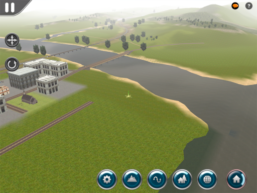
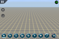
Once you are in Surveyor, you will be presented with a screen layout similar to the following image:
In the top left of the screen is the main menu button. On the left side of the screen are the camera control buttons. On the top right of the screen are the utility buttons, and at the bottom right of the screen is the Surveyor Menu from which you can access all Surveyor functionality. Each part of the screen is described in detail below.
Note: The "?" icon is not present in Trainz Driver 2. You can access Help in the Main Menu (pause). This Help option displays the Trainz Mobile Wiki with full help details of every game function.
Main Menu
![]() At the top left of the Surveyor screen is a "pause" icon button, which displays the Main Menu. The following options are available from this menu:
At the top left of the Surveyor screen is a "pause" icon button, which displays the Main Menu. The following options are available from this menu:
- "Back to Game" - Dismisses the menu and returns you to Surveyor.
- "Help" - Displays the Trainz Mobile Wiki with full help details of every game function (option in Trainz Driver 2 only)
- "Options" - Displays the game options dialog.
- "Account Details" - Allows editing of the Planet Auran account details.
- "Achievements" - Shows the list of achievements, including the current progress toward further achievements.
- "Save" - Saves the current Surveyor route and/or session. If you are editing a new route or session, this will prompt you for an appropriate save name.
- "Save As" - Saves the current Surveyor route and/or session, prompting for a new save name.
- "Find Object" - Allows you to find a named object on the route.
- "Exit Surveyor" - Exits Surveyor and returns to the Main Menu. Surveyor will offer to save any edits made to the current route and/or session.
Camera Controls
Camera Mode Buttons
Two camera control buttons are available on left side of the screen. These buttons are, from top to bottom:
- "Move Camera" - Tap this button to enter "move" mode. Drag anywhere on the 3D world to move the camera. If the button is held instead of tapped, you can make a quick multi-touch adjustment to camera position without changing modes.
- "Rotate Camera" - Tap this button to enter "rotate" mode. Drag anywhere on the 3D world to rotate the camera without changing the center of focus. If the button is held instead of tapped, you can make a quick multi-touch adjustment to camera position without changing modes.
Whenever a camera mode button is activated, the current Surveyor editing tool is temporarily deactivated. If you tap the active camera mode button a second time, it will deactivate returning you to the previously selected Surveyor editing tool.
If no Surveyor editing tool is currently active, any touch gesture will be treated as per "Move Camera" mode.
Multitouch Gestures
In both camera adjustment modes, pinching will zoom the camera. At extreme distance, the camera will automatically adjust to face directly downward, and the view will transition between the local 3D view and a "minimap" overview.
In both camera adjustment modes, sliding two fingers vertically will cause the camera to tilt up or down, changing the angle of the horizon.
In the "move" camera mode, rotating two fingers in place on the screen will cause the camera to rotate around its point of focus.
Surveyor Menu
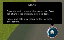
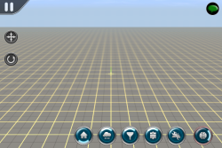
The Surveyor menu is accessed through an omnipresent button at the bottom right of the screen. This button changes icon to show the current menu mode, but always has the same functionality: tap the button to reveal the menu buttons, and tap it again to hide them. Hiding the menu buttons does not deactivate the currently selected tools or options, it simply clears up some screen space so that you can work unrestricted.
Tapping and holding any menu button causes a popover to open which both display help on the button in question, and also (where applicable) presents options that can be adjusted which relate to the button.
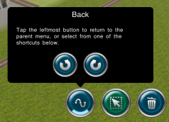
Each other button on the top-level menu represents one of the major categories of Surveyor editing tools. Tapping any of these buttons opens a separate menu of related tools. The Surveyor menu button icon will change to reflect your selected category. When in any submenu, the leftmost button is always a "back" button. The back button also offers "undo" and "redo" options in case you need to access these functions quickly.
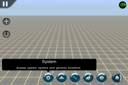
Whenever you tap or hold on a menu button, the name of that button will appear briefly. This can act as a quick confirmation that you've got the right button, or can be used to understand what action an unknown button might perform. If you decide that you've tapped the wrong button, you can drag your finger off the button before lifting to cancel the tap.
Within each menu category are a number of different tools and commands relating to that category. These are reviewed in detail below, however there are some common visual effects which help guide you through the buttons. Understanding these up-front will help with learning your way around the menus.
Firstly, each menu button may have a highlight on the top, bottom, left, or right. These are used as follows:
- Top - A button with a top highlight has a sub-menu. Tapping the button will leave the current menu and reveal the sub-menu.
- Bottom - The back button has a bottom highlight. Tapping the back button will leave the current sub-menu and return to the parent menu.
- Left / Right - The Surveyor menu button will show a left or right highlight depending on its current mode. This indicates that the menu will expand or contract (respectively) when this button is tapped.
Secondly, each menu button has a colored background:
- Blue - The blue buttons are commands. Tapping the button will have an immediate effect, whether this is to open a sub-menu or to perform a set action.
- Green - The green buttons are tools. Tapping the button will activate the tool, but will not have any immediate effect. You can then tap in the 3D world to utilise the button. In some cases you may need to customise the tool options by pressing and holding on the tool's button. The currently active tool has a brighter-colored button background.
System Menu
Ground Menu
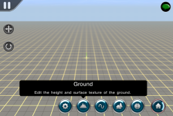
The Ground Menu allows users to sculpt and paint the terrain and add water to the world
Ground Tools
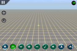
- Select the function you wish to perform by tapping on the appropriate tool. The selected tool is highlighted.
- Tap and hold on the tool to bring up any sub-menu tool options.
Height Up
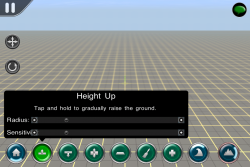
- With Height Up selected, tap and hold to raise the terrain.
- Tap and drag to slowly around the world to create hills
- Adjust the radius by dragging the slider left or right.
- The size of the radius determines the area of influence the tool has.
- Adjust the sensitivity to make the tool act quicker or slower.
Height Down
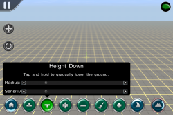
- As per Height Up, except this tool lowers the terrain.
Height Adjust
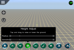
- Tap and drag up or down to make fine adjustments to the terrain.
Plateau
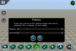
- Tap to start creating a level area in the location of your tap.
- Tap and hold to completely flatten the terrain
- The height of the plateau us determined by the height at the location of your tap.
Plateau - Smooth
- Tap and hold the Plateau tool to bring up the additional tools
- Tap to select Smooth
- Tap the Plateau tools again to close the window
- Tap in the world to smooth the terrain at the location of your tap.
- Tap and hold or drag to continue smoothing
Plateau - Grade
- Tap and hold the Plateau tool to bring up the additional tools
- Tap to select Grade
- Tap the Plateau tools again to close the window
- Tap in the world to create a grade (i.e. consistent slope) on the terrain at the location of your tap.
- Tap and hold or drag to continue adding a grade to the terrain.
Paint
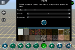
- Tap and hold to open the Paint Palette
- Select a texture from the palette
- Tap the Paint button again to close the window
- Tap and drag to paint the terrain
- Filter: Type in the selection field to filter to textures including the words. e.e. 'grass' or 'rock'
- Scale: Adjusts the texture scale
- Rotation: Rotates the direction of the texture
Add Baseboard
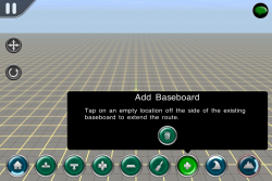
- Navigate to the edge of the current baseboard
- Tap Add Baseboard
- Tap off the edge of the world to add a new baseboard
- Delete: With Delete selected, tap on a baseboard and confirm you wish to delete the baseboard selected.
Water
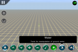
- Tap to open the water tools
Add Water
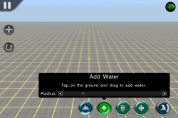
- Tap and drag to paint the terrain with a water texture
- Adjust the radius to paint more or less water with each brush stroke.
Remove Water
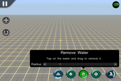
- Tap and drag to erase the water texture
- Adjust the radius to erase more or less water with each brush stroke.
Adjust Water Height
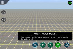
- Tap and drag up or down to raise or lower the water texture
Splines Menu
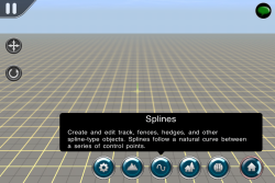
Splines are special objects that stretch between two nodes. Splines are flexible. They can bend and curve, raise above the terrain or hug the terrain closely.
Spline Tools
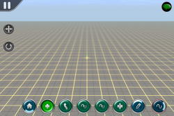
There are a variety of tools that enable the user to manipulate the splines in a wide variety of ways.
Add Spline
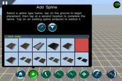
- Tap the Add Spline button to open the selection window
- Select an item from the scrollable list (use Filter first, if required)
- Tap the Add Spline button to close the window
- Tap in the 3D world to place the first "node", then tap again to place the second "node".
- Tap on one of the existing nodes then tap again to extend the spline.
Using the Object Picker
- Tap the Add Spline button to open the selection window
- Tap the Picker button (use Filter first, if required)
- Tap the Add Spline button to close the window
- Tap an item in the 3D world (the selection window appears to confirm the item selected)
- Tap the Add Object button to close the window
- With your new spline selected, tap twice in the 3D world to place your spline.
Using the Object Filter
The filter allows a user to reduce or increase the number of items showing in the selection window. There are two types of filter:
- Content Type: Tap the filter buttons to toggle various content types on or off. This is very useful to show just the type of object that you are currently working with.
- Item Name: Type in the name field to filter any items that include the characters typed. e.g. type 'road' to show items with the word 'road' in the name
Move Spline
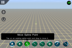
- With the Move Spline tool selected, tap on any node and drag to move the node.
- Only Objects in the current Filter can be moved.
- Use the navigation tools to change your camera position and pinch to zoom in and out.
- Moving the camera will deselect the move tool, so select it again to continue moving the objects.
Insert Spline
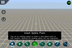
Used to gain finer control over your spline.
- Tap the Insert Spline button then tap on the spline to insert a new node at that point.
Delete Spline Point
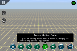
- Tap the Insert Spline button then tap on an existing node on the spline to delete that node.
Adjust Spline Point
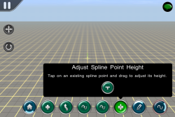
- Tap the Adjust Spline Point button then tap and drag up or down to raise or lower that node.
- Reset Spline Point Height: With the button selected tap on a node to reset to the previous height.
Edit Splines
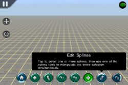
Access additional spline tools
Select Splines
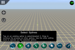
- Tap on any spline section to select
- Tap again to deselect
- Use the other tools to manipulate the selected items
Delete Selected Splines
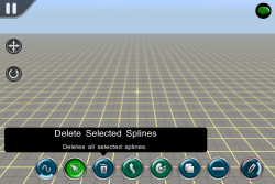
- Tap the delete button to instantly delete the selected splines
Move Selected Splines
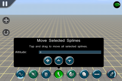
- Tap and drag the selected splines to move them without changing their orientation
- Note that non-selected splines attached to either end will be stretched and remain attached.
Rotate Selected Splines
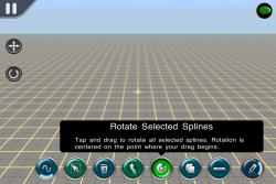
- Tap and drag the selected spline to rotate the selection and stretch attached splines at each end.
- The point of rotation is based upon where you tap along the selected splines.
Copy Selected Splines
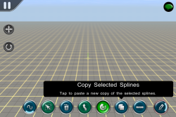
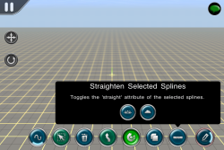
Straighten Selected Splines
Toggle Gradient
Smooth Spline
Objects Menu
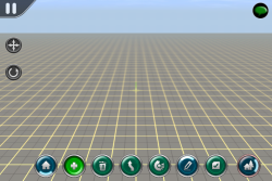
- The currently selected tool is highlighted green.
- The selected tool determines what happens to the object when you tap or drag on the screen.
- Tap and hold to open any sub-menu options.
- Tap another tool to change your selection.
Adding an Object to the 3D World
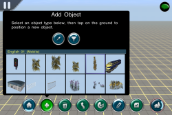
- Tap the Add Object button to open the selection window
- Select an item from the scrollable list (use Filter first, if required)
- Tap the Add Object button to close the window
- Tap in the 3D world to place the item
- Tap again to place another item in the world
Using the Object Picker
- Tap the Add Object button to open the selection window
- Tap the Picker button (use Filter first, if required)
- Tap the Add Object button to close the window
- Tap an item in the 3D world (the selection window appears to confirm the item selected)
- Tap the Add Object button to close the window
- Tap in the 3D world to place the selected item
Using the Object Filter
The filter allows a user to reduce or increase the number of items showing in the selection window. There are two types of filter:
- Content Type: Tap the filter buttons to toggle various content types on or off. This is very useful to show just the type of object that you are currently working with.
- Item Name: Type in the name field to filter any items that include the characters typed. e.g. type 'mobile' to show items with the word 'mobile' in the name
Deleting an Object
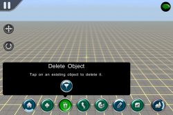
- With the Delete Object tool selected, tap on an object in the 3D world to delete it.
- Only Objects in the current Filter can be deleted.
- Splines cannot be deleted in the Objects menu.
- Use the Undo button to reverse an incorrectly deleted object.
Moving an Object
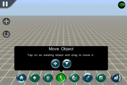
- With the Move Object tool selected, tap on an object in the 3D world to move it.
- Only Objects in the current Filter can be moved.
- Use the navigation tools to change your camera position and pinch to zoom in and out.
- Moving the camera will deselect the move tool, so select it again to continue moving the objects.
Object Height Adjust
- Tap and hold the Move Object button to bring up the Height Adjust tool.
- Tap and drag upwards to raise the object off the ground.
Rotating an Object
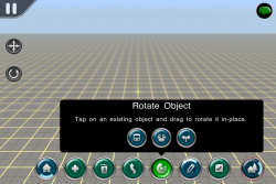
- With the Move Object tool selected, tap on an object then drag your finger away from the object to rotate it.
- Move back and forwards to continue adjusting the rotation
- Only Objects in the current Filter can be rotated.
Additional Rotate Tools
- Tap and hold the Rotate Object button to bring up additional tools.
- Tap Rotate Consist then tap on a train to reverse the whole train on the tracks
- Tap Reverse Consist Heading then tap on a train to change train direction heading arrows (but not the train itself)
- Tap Toggle Junction then tap on the junction arrows to change the default junction direction.
Edit Objects Menu
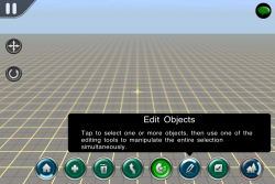
- Tap the Edit Objects button to open a set of advanced tools.
- Tap the left hand icon to go back to the main Objects menu.
Select Objects
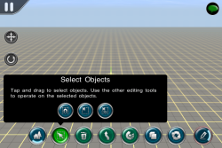
- Tap Select Objects then tap on any item in the world to select that item
- Tap again to deselect the item or tap on another item to add it to the current selection
- You can add many items to your current selection and they will all respond to the function of the next tool chosen.
- Tap on Select Similar to add all similar items to the selection.
- Tap Deselect All to remove all items from your selection.
- Tap Deselect 10% to remove a random group of items from your selection. Press again to reduce numbers further.
Delete Objects
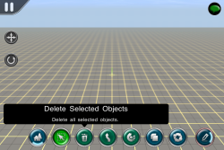
- With the Delete Selected Objects tool selected, tap on any selected object in the 3D world and all selected objects will be deleted.
Move Objects
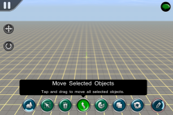
- With the Move Selected Objects tool selected, tap and drag on any selected object in the 3D world and all selected objects will be moved together.
Rotate Objects
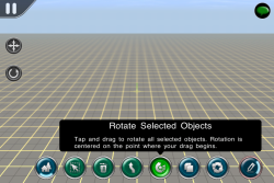
- With the Rotate Selected Objects tool selected, tap and drag on any selected object in the 3D world and all selected objects will be rotated together.
- The center of rotation is based upon where you tap and drag.
Copy Selected Objects
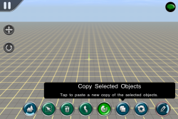
- With a number of items selected, tapping the Copy Selected button will show a selection box outlining the limits of the Objects selected.
- Tap again in the world to paste a copy of those selected Objects.
- Note that any other Objects within the paste area will be deleted.
- To copy and paste terrain, textures and other item types, use System > Edit > Copy/Paste.
Replace Selected Objects
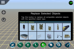
- First, select an Object or multiple objects that you want to replace
- Then tap the Replace Objects button and select the item you want to use as the replacement item
- Tap the Replace Objects button to close the window
- Tap the Replace Objects button again to replace the selected items with the new replacement.
Edit Object Properties
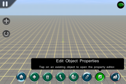
- Tap on an item to open the Properties window.
- This option allows you to name items and to set various scripted elements if supported by that object.
Environment Menu
Weather
Adjust the weather conditions for the session you are editing
- Select the Skybox
- Select the type of weather (rainy, snowing, fine)
- Select the height that snow assets are shown
Filter
Toggle which asset types are shown in picker lists or selected in the world. The filter is applied globally, so changing the filter here can be overridden by changing the filter wherever it appears.
Layers
Objects in Surveyor are divided between the Route and Session. Typically, the Route will represent an entire map including the ground, water, scenery, industries, track, signals and junctions. These features are then common to every session which is built for that route. The sessions will add specific gameplay-relevant objects and mechanics including Trains and Session Rules, although it is also possible to add extra track-work, signals, track marks, and so forth. It is actually possible to place most objects in either the route or session, with the exception of the ground height, texture, and water (which is route only) and the session rules (which are session only.)
Within both the route and the session, objects can be further subdivided between individual layers. Placing an object into a particular layer does not typically have any gameplay impact, however it can be used to simplify editing. For example, by placing all trees and similar scenery into a separate layer, you can hide them all temporarily when working on the track or other aspects of the route, or you can lock the layer to prevent accidental edits.
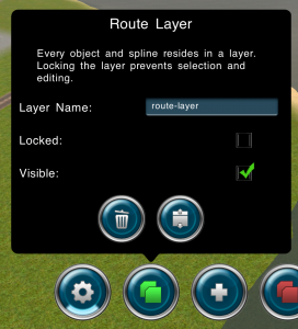
To access the layer controls, expand the surveyor menu buttons, tap on the "Environment" button from the top-level menu, then tap on the "Layers" button. A list of all available layers is displayed, with route layers on the left and session layers on the right. "Add" buttons are available to insert new layers into either the route or session. The currently selected layer is shown in green. All editing operations which affect a specific layer (such as adding new objects) will modify the selected layer. To change to a different layer, simply tap on the appropriate button so that it turns green. Multiple layers may be visible and unlocked simultaneously, but only one layer is selected.
Pressing and holding on any layer button will reveal the options popover for that layer. This allows you to show or hide the layer, lock or unlock the layer, rename the layer, delete the layer, or merge the layer into another.
Protected Content
Some content is protected from editing and/or cloning. For example, purchased content is not typically available for cloning or modification. Access to protected content is permitted as follows:
- Payware Routes - Payware routes cannot be edited. It is possible to create a new session for an existing payware route, however.
- Payware Sessions - Payware sessions cannot be edited.
- Download Station Content - Routes and Sessions downloaded from the Trainz Download Station must be cloned before editing. The main menu will prompt you about this if it is required. You do not need to take additional steps except where prompted.
Other Topics
Select the area within Trainz Mobile you want to explore.
