This is the original v1.0 Methuen Map and description. For the latest SAR Peterborough Narrow Gauge Division v2.0 version click here. The V2.0 version of the route and sessions requires Trainz Plus or TRS22
Facilities:
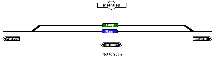
Loop
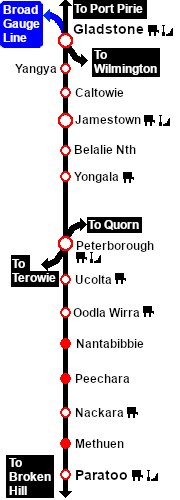
Distance from Peterborough: 54 kms, 33½ miles
Unmanned location on the Port Pirie-Broken Hill Line .
Crossing loop.
The loop was removed when the line was converted to standard gauge (4ft8½in - 1435mm) during 1969-1970.