|
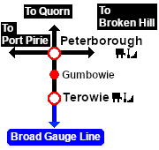
Distance from Terowie: 21¾ kms, 13½ miles from Peterborough: 11¼ kms, 7 miles
Unmanned location on the Peterborough-Terowie Line .
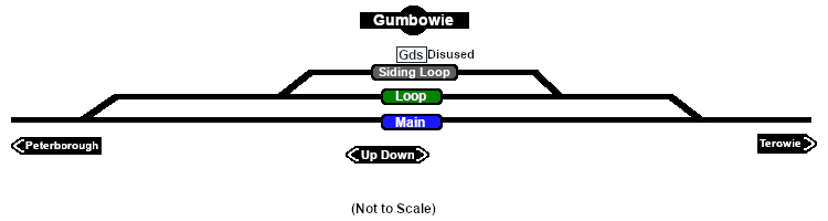
Crossing and siding loops.
A signal box and a small station building that were originally present on the main line had been removed by the start of the 1960s. After Belalie North was bypassed by the gauge conversion (1969-70) Gumbowie at 610m (2001ft) became the highest point in the SAR system.
The main line and crossing loop were converted to dual gauge with the addition of a broad gauge (5ft3in - 1600mm) track to the existing narrow gauge (3ft6in - 1067mm) main line and loop in 1970 but the siding remained narrow gauge only. The Peterborough-Terowie Line was closed in 1988.
Today nothing remains at Gumbowie to indicate that it was once a railway location.
|