SAR Ucolta V2
From TrainzOnline
(Difference between revisions)
m |
|||
| Line 86: | Line 86: | ||
<tr valign="top"> | <tr valign="top"> | ||
<td width=750> | <td width=750> | ||
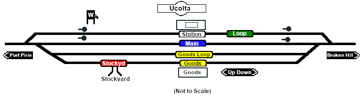
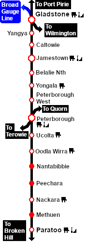
| − | <span style="font-weight: 700;"><span style="color: white; background-color: black;"> Distance from | + | <span style="font-weight: 700;"><span style="color: white; background-color: black;"> Distance from Peterborough: </span> 13¼ kms, 8¼ miles</span><br> |
| + | Unmanned station on the <span style="font-weight: 700; color: white; background-color: black;"> Port Pirie-Broken Hill Line </span>.<br> | ||
| − | + | Crossing, station and goods/stockyard loops with loco watering facilities.<br> | |
| − | + | After the conversion of the line to standard gauge (1969-70) '''Ucolta''' became just a crossing loop with a single goods siding. More recently, the loop and siding have been removed. The station is no longer in use. | |
| − | + | ||
| − | After the conversion of the line to standard gauge ( | + | |
</td> | </td> | ||
</tr> | </tr> | ||
Revision as of 08:30, 28 April 2024
|
 |