From TrainzOnline
(diff) ← Older revision | Latest revision (diff) | Newer revision → (diff)
 |
| Updated for SAR Peterborough Narrow Gauge Division v2.0. For the original V1.0 version click here |
|
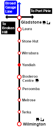
Distance from Gladstone: 58¾ kms, 36½ miles
Unmanned station on the Gladstone-Wilmington Line .
A passenger shelter and a goods loop.
The Gladstone-Wilmington Line is unsignalled. Train Order working is in operation on the line.
Passenger services ended in 1969. The line was closed in 1990 and the track has since been removed.
The former right-of-way from just south of Laura to Wilmington is now an 80km walking, cycling and horse riding trail, the Southern Flinders Rail Trail.
|
 |
|


|