SAR Belalie North TrackMarks

From TrainzOnline
(Difference between revisions)
Jump to: navigation, search
m
m
Line 29: Line 29:
 
[[image:SAR_Belalie North_TM.png|link=|alt=Belalie North map]]
 
[[image:SAR_Belalie North_TM.png|link=|alt=Belalie North map]]
  
<table bgcolor="LightYellow" width=750> <!-- BEGIN Track Markers table -->
+
<table bgcolor="Aquamarine" width=750> <!-- BEGIN Track Markers table -->
  
 
<tr valign="top">
 
<tr valign="top">

Revision as of 21:30, 21 December 2020

Line740.png
Tab HM Grey.png Tab IN Grey.png Tab TM White.png Tab PH Grey.png Tab SW Grey.png
Line740.png
PortPirie-BrokenHill
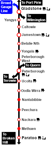
Jamestown
Location Index
Yongala
PortPirie-BrokenHill

Belalie North map

Line740.png
 Track Markers 
Destinations for "Drive To Trackmark ..." commands
 Approach from Port Pirie     TM Belalie Nth Main Approach Dn
 Approach from Broken Hill   TM Belalie Nth Main Approach Up
Station  TM Belalie Nth Station Up TM Belalie Nth Station Dn
Main  TM Belalie Nth Main Up TM Belalie Nth Main Dn
Loop  TM Belalie Nth Loop Up TM Belalie Nth Loop Dn
Goods  TM Belalie Nth Goods Up TM Belalie Nth Goods Dn
GoodsSd  TM Belalie Nth Goods Up DE  
GoodsSd    TM Belalie Nth Goods Dn DE
Siding  TM Belalie Nth Neck DE  
Line740.png

PortPirie-BrokenHill

Gladstone-Paratoo Strip Map
Personal tools