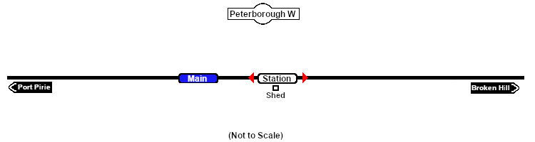
| Peterborough West is a location added to SAR Peterborough Narrow Gauge Division v2.0 |
 |
 |
| Track Marks |
| Destinations for "Drive Via Trackmark NAME " or "Drive To Trackmark NAME " AI commands. The direction that a track mark points has no effect on its operation. |
|
 |
 Peterborough West Halt Up Peterborough West Halt Up |
 Peterborough West Halt Dn Peterborough West Halt Dn |
|
|
 |
