File:SAR Orroroo Paths.png
From TrainzOnline
No higher resolution available.
SAR_Orroroo_Paths.png (750 × 200 pixels, file size: 24 KB, MIME type: image/png)
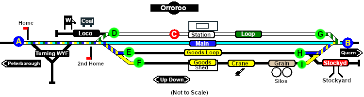
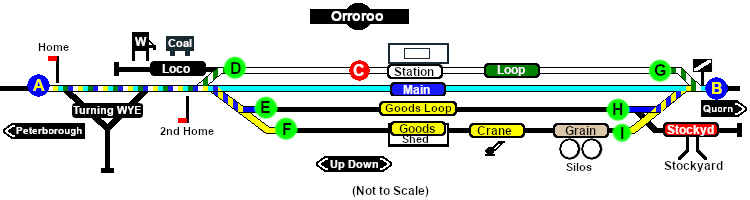
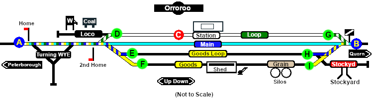
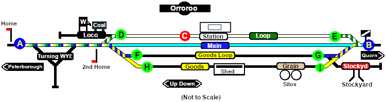
Paths map of Orroroo
File history
Click on a date/time to view the file as it appeared at that time.
| Date/Time | Thumbnail | Dimensions | User | Comment | |
|---|---|---|---|---|---|
| current | 10:26, 4 October 2021 | 750 × 200 (24 KB) | Pware (Talk | contribs) | Removed mechanical junction signals | |
| 10:29, 1 February 2021 | 750 × 200 (24 KB) | Pware (Talk | contribs) | Map update | ||
| 14:27, 28 January 2021 | 750 × 200 (24 KB) | Pware (Talk | contribs) | Update | ||
| 13:15, 17 December 2020 | 750 × 200 (24 KB) | Pware (Talk | contribs) | reorganised markers | ||
| 14:35, 6 December 2020 | 750 × 200 (24 KB) | Pware (Talk | contribs) | minor edits | ||
| 20:21, 25 November 2020 | 750 × 200 (24 KB) | Pware (Talk | contribs) | Paths map of Orroroo |
- Edit this file using an external application (See the [//www.mediawiki.org/wiki/Manual:External_editors setup instructions] for more information)
File usage
The following page links to this file: