File:SAR Carrieton Industry.png
From TrainzOnline
No higher resolution available.
SAR_Carrieton_Industry.png (750 × 200 pixels, file size: 15 KB, MIME type: image/png)
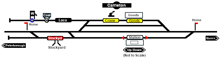
Industry map of Carrieton
File history
Click on a date/time to view the file as it appeared at that time.
| Date/Time | Thumbnail | Dimensions | User | Comment | |
|---|---|---|---|---|---|
| current | 16:31, 1 February 2021 | 750 × 200 (15 KB) | Pware (Talk | contribs) | Map update | |
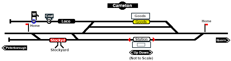
| 14:48, 27 January 2021 | 750 × 200 (15 KB) | Pware (Talk | contribs) | Update | ||
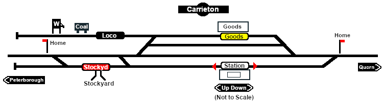
| 15:56, 12 January 2021 | 750 × 200 (15 KB) | Pware (Talk | contribs) | minor modification | ||
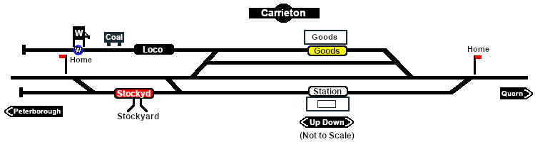
| 20:19, 16 December 2020 | 750 × 200 (14 KB) | Pware (Talk | contribs) | added station trackmarks | ||
| 20:10, 6 December 2020 | 750 × 200 (14 KB) | Pware (Talk | contribs) | minor edits | ||
| 19:42, 26 November 2020 | 750 × 200 (14 KB) | Pware (Talk | contribs) | Industry map of Carrieton |
- Edit this file using an external application (See the [//www.mediawiki.org/wiki/Manual:External_editors setup instructions] for more information)
File usage
The following file is a duplicate of this file (more details):
The following page links to this file: