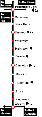
Links updated for SAR Peterborough Narrow Gauge Division v2.0. For the original V1.0 version click here
V2.0 requires Trainz Plus or TRS22 to run
Loco Services:
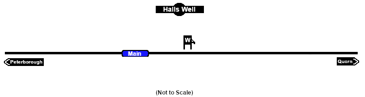
Water
Distance from Peterborough: 51½ kms, 32 miles
Unmanned location on the Peterborough-Quorn Line .
A water tower on the main line. No sidings or loops.
The tank was filled with water from a well which was purchased from a Mr Hall in 1897 (hence the name Halls Well) and was notable as being the only source of underground water used by the SAR. It was mostly used as a "top-up" for freight trains making the long climb from Orroroo to Eurelia which has some of the steepest grades on the line.