SAR Gumbowie
From TrainzOnline
(Difference between revisions)
m |
m |
||
| Line 77: | Line 77: | ||
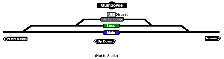
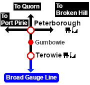
Unmanned location on the <span style="font-weight: 700; color: white; background-color: black;"> Peterborough-Terowie Line </span>.<br> | Unmanned location on the <span style="font-weight: 700; color: white; background-color: black;"> Peterborough-Terowie Line </span>.<br> | ||
| − | Passing and siding loops. A signal box and a small station building that were originally present on the main line had been removed by the start of the 1960s.<br> | + | Passing and siding loops. A signal box and a small station building that were originally present on the main line had been removed by the start of the 1960s. After '''Belalie North''' was bypassed by the gauge conversion (1969-70) '''Gumbowie''' became the highest point in the '''SAR''' system.<br> |
The loop and siding were removed when the line was converted to broad gauge (5' 3", 1600mm) in 1970. | The loop and siding were removed when the line was converted to broad gauge (5' 3", 1600mm) in 1970. | ||
Revision as of 10:04, 26 January 2021
|
 |