File:SAR Hawker Line Strip Map.png
From TrainzOnline
No higher resolution available.
SAR_Hawker_Line_Strip_Map.png (180 × 329 pixels, file size: 14 KB, MIME type: image/png)
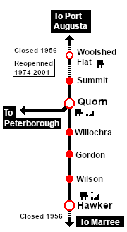
Strip map for the Hawker Line (Woolshed Flat to Hawker) on the SAR Northern Narrow Gauge Division
File history
Click on a date/time to view the file as it appeared at that time.
| Date/Time | Thumbnail | Dimensions | User | Comment | |
|---|---|---|---|---|---|
| current | 08:52, 7 September 2022 | | 180 × 329 (14 KB) | Pware (Talk | contribs) | Update |
| 10:20, 2 August 2022 | 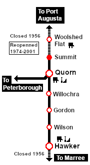 | 180 × 329 (14 KB) | Pware (Talk | contribs) | Spelling correction | |
| 07:00, 13 November 2021 | 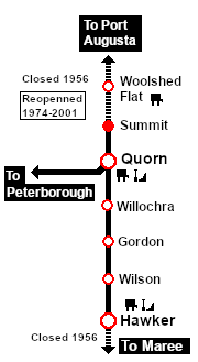 | 180 × 329 (14 KB) | Pware (Talk | contribs) | Simplified | |
| 11:40, 29 August 2021 | 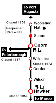 | 180 × 329 (15 KB) | Pware (Talk | contribs) | Updated information | |
| 22:24, 31 July 2021 | 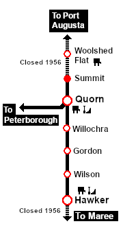 | 180 × 329 (13 KB) | Pware (Talk | contribs) | Strip map for the Hawker Line (Woolshed Flat to Hawker) on the SAR Northern Narrow Gauge Division |
- Edit this file using an external application (See the [//www.mediawiki.org/wiki/Manual:External_editors setup instructions] for more information)
File usage
The following page links to this file: